Buoy CMAN and Ship Data
- Buoy Search, Radial Search by Lat/Lon
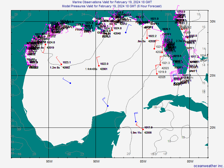
- Gulf of Mexico- List or Plot
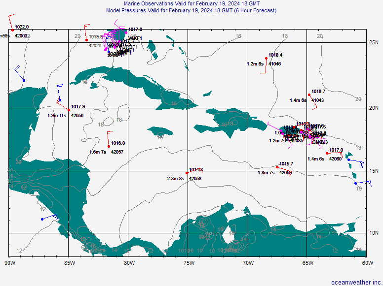
- Caribbean Sea- List or Plot
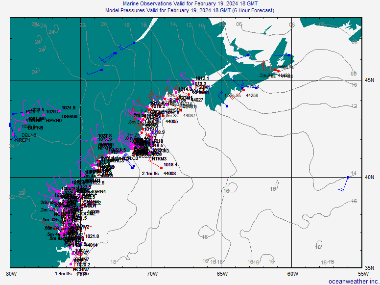
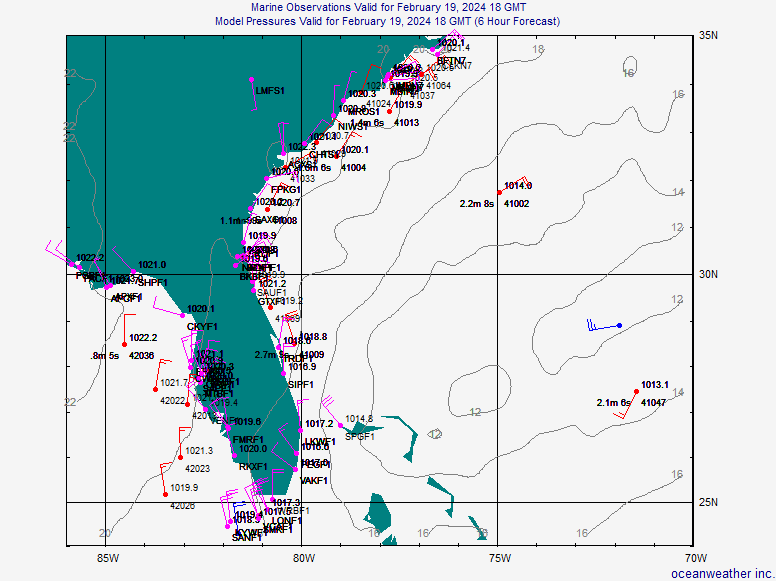
- NE and SE USA-- NE US Plot or SE US Plot
- Tropical Atlantic-- List or Tropical Atlantic Plot
- All Reports- Text or Plot
- National Data Buoy Center Marine Observations
- Realtime TAO Buoy Data Display (Pacific)
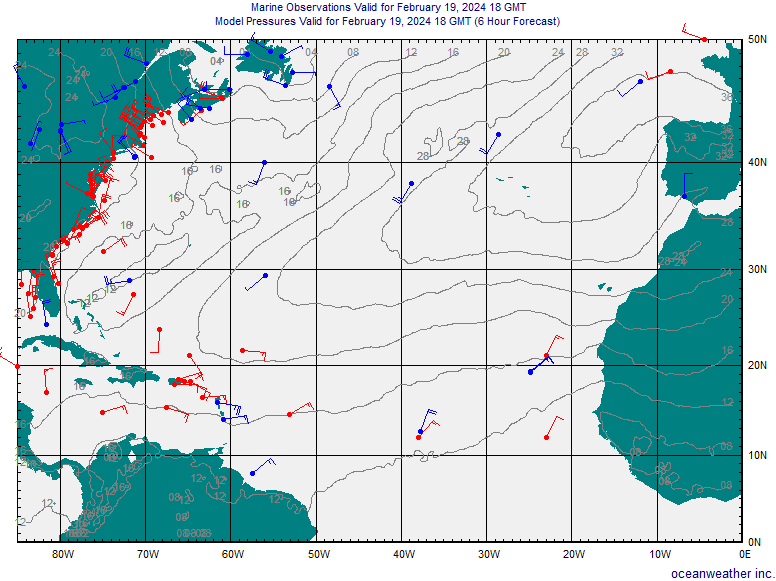
- Gulf of Mexico, Caribbean Sea, NE USA, SE USA, N. Atlantic Plotted Marine Observations
- Atlantic Current Wave Heights & Mean Direction and Forecasts-
- Forecast of E. Coast, W Caribbean & Gulf--Wave Height, Period & Direction-- Wave Forecasts (NOAA)
- Tide Information for the United States
- Daily Atlantic Analysis or Loop (NOAA)
- Weekly SST Analysis, Weekly SST Anomalies (BOM)
- NOAA Satellite-Only Daily SST Anomaly Charts
- Weekly Global deviation from climatology, Monthly Anomalies (EMC)
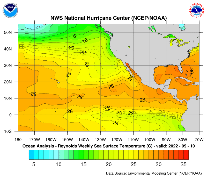
- Weekly Atlantic Reynolds SST and Anomalies from Climatology (NHC)
- Weekly E. Pacific Reynolds SST and Anomalies from Climatology (NHC)
- Daily Atlantic SST Analysis and Anomalies (NCEP)
- Global SST (Daily) (SSEC)
- SST Data from REMSS
- Lots of SST Data from AVHRR
- Upper Layer Thickness & Heat Content in the Gulf (RSMAS/NOAA) TOPEX/Poseidon
- More TOPEX/Poseidon plots (NRL)
- SST analysis and potential maximum winds of a hurricane
- Monitoring Atlantic Hurricane Potential (NOAA)
- MEI ENSO Discussion and Maps
Wave Heights & Forecasts-
Sea-Surface Temperature Data-
Reconnaissance Flights
- ~~~Caribbean SST analysis NAVO
- ~~~Daily Global Analysis and Deviation from Climatology (NLMOC)
- ~~~Weekly Global Analysis and Deviation from Climatology (NCEP)
- ~~~Monthly Global Analysis and Deviation from Climatology (NCEP)
