Satellite Images
- Eastern US, Gulf of Mexico, and Extreme W. Atlantic Current Images
- Tropical Atlc Satellite Stills and Loops (UHawaii)
- Latest Visible of: NW Caribbean and GOM, Atlantic Ocean, Gulf of Mexico (COD)
- Latest Infrared of: NW Caribbean and GOM, CONUS, N Hemisphere (COD)
- CIMSS Tropical Cyclones
- Plymouth State Weather Tropical Cyclones
- NRL Tropical Satellite Views
- Latest Visible Floater (storm only) (UCAR)
- Latest Visible of Gulf of Mexico or E. Gulf & W. Atlantic or N. Central Gulf
- Latest Visible of Carolina Coast or Mid-Atlantic or NE US (UCAR)
- Latest Visible or Infrared or Water Vapor of W. Atlantic Basin (NOAA)
- CIRA Satellite Images (CSU)
- Latest Infrared Color of Caribbean Sea or Gulf of Mexico or Atlantic Basin or Africa (TWC)
- Latest Visible or Infrared or Enhanced Infrared or Water Vapor (Unisys)
- Great Satellite Pictures (UWyoming)
- High Detail Visible or Infrared or Water Vapor Image (UWisc)
- High Detail Visible or Infared or Water Vapor Image (UWash)
- NOAA Satellite Site
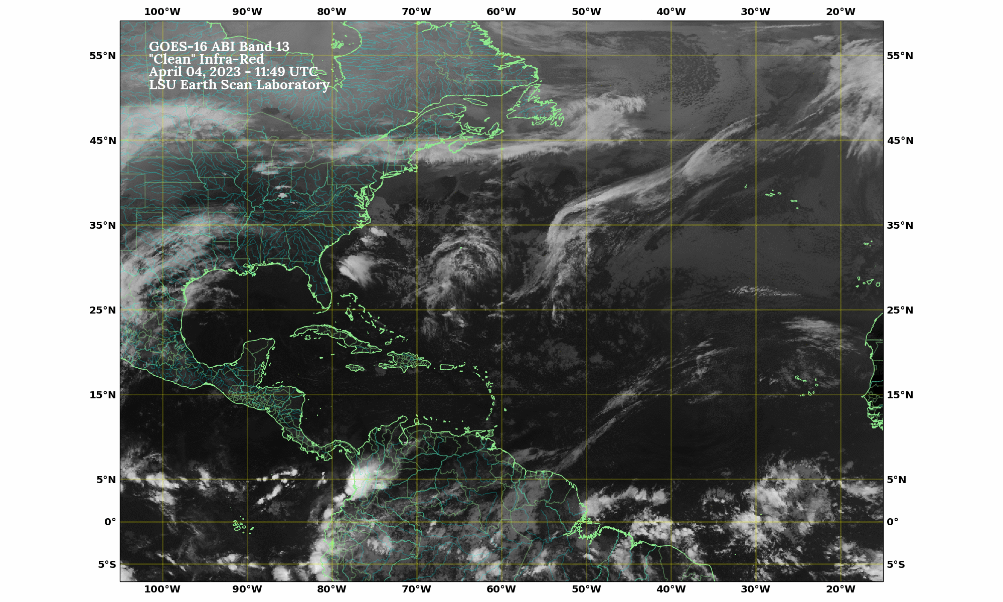
- Latest Visible or Infrared or Water Vapor or False Color Atl. Basin (LSU)
- GOM & Carib IR (LSU)
- If you can't find what you are looking for, visit David Baron's International Satellite Page.
- Caribbean Sea, Atlantic Ocean, and African Current Images
- Meteosat 7/8 Imagery
- Satellite Derived Winds of Tropics
Satellite Loops
- Tropical RAMSDIS or Barbados or Costa Rica & Caribbean or Rapid Scan Operations Loops (CIRA)
- Interactive Global Infrared or Water Vapor Viewer (GHCC/NASA)
- W. Atl Visible or Infrared or Water Vapor (GHCC/NASA)
- Tropical Atlantic Basin Visible or Infrared or Water Vapor (GHCC/NASA)
- Large Atlantic/EPAC Tropics Visible or Infrared or Water Vapor (GHCC/NASA)
- Water Vapor or Infrared or Color IR Java of W. Atlantic Basin (SSEC)
- Water Vapor or Infrared of E. Atlantic & Africa (SSEC)
- Infrared or Water Vapor of Entire Atlantic Basin (SSEC)
- NOAA Satellite Loops
- UCAR Satellite Loops
- West Atlantic Visible or Infrared or Enhanced Infrared or Water Vapor (Unisys)
- Atlantic Ocean or Caribbean Sea or Gulf of Mexico or Africa (TWC)
- All Kinds of Loops from NRL Monterey
- Scatterometer Winds- QuikSCAT (NOAA)
- or Navy version
- SSMI Data
- Another Winds Site
- Data for Atlantic Basin on 1 map
